

Capturing metadata for GeoNode in QGIS
“Metadata is data about data. It describes the characteristics of the data e.g title, abstract, author, and keywords”
GeoNode publishes spatial data and its metadata. Whilst GeoNode has the ability to generate metadata and tools for you to populate it, QGIS provides an interface where users can pre-generate full metadata and associate it with a layer during upload.
You try:
Goal: To explore metadata capabilities in QGIS
- Load your Layers into QGIS
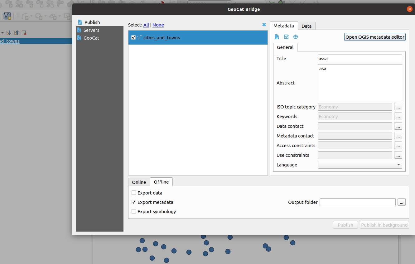
- Install the GeocatBridge plugin.
- In the Publish tab populate all metadata for your layer.
- Open the QGIS metadata editor within the plugin dialog.
- Validate all the metadata that has been generated.
- Select Offline editing and export the metadata.
- Export the vector layer onto the disk.
- Navigate to GeoNode and upload the vector layer with the XML(metadata document)
- Visualize the loaded layer and it's metadata.
| Name | Expectation |
|---|---|
Layers |
OGR or GDAL data layers |
Metadata tool |
MetaTools plugin |
Keywords tool |
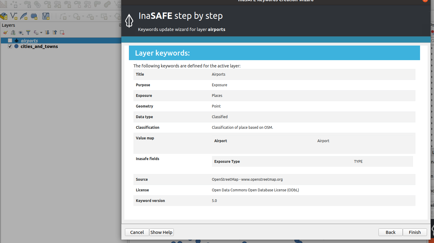
InaSAFE plugin |
Metadata file |
.xml in ISO 19115 format |
More about metadat in external clients
In QGIS there are various ways to populate metadata. The native QGIS metadata editor does not allow users to download metadata in standard compliant. QGIS leverages this by using third-party plugins ie InaSAFE, GeocatBridge plugin, Metatools.
Other third-party tools like InaSAFE are not designed wholly to manage the import or export of metadata records hence there is some learning required to use the tool.
When InaSAFE generates metadata it populates only a subset of the metadata fields, including adding the keywords to the Supplemental Data field. Utilizing tools like MetaTools allows us to add extra detail to the metadata so that users can fully understand all elements of our data.
Richly populated metadata is important for many reasons, here are just a few:
- recording the provenance of the data
- recording the processing history
- noting the correct attribution
- providing details of any access constraints
- providing web service access URLs
- providing contact information
- being interoperable with other ISO 19115 compliant metadata systems
- complying with regulations and policies. e.g. INSPIRE in Europe.

Check your knowledge:
-
Why would a user choose GeoCatBridge plugin over native QGIS metadata editor to generate metadata for use in GeoNode:
- QGIS Metadata editor only works with vector layers
- QGIS Metadata editor only produces a subset of the metadata records supported by GeoNode
- QGIS does not export the metadata into a format that GeoNode understands
-
Metadata generated from InaSAFE and GeoCatBridge can be ingested in GeoNode but they are produced with different tools. Why is that:
- The metadata contains Keywords and this allows them to be used in GeoNode
- GeoNode does not care about the contents and structure as long as the metadata file has the extension (.xml)
- They all produce metadata that adhere to some common standard
